
Wasatch Mountain Range Images
The Wasatch Mountain Range runs about 160 miles from the Utah-Idaho border south to central Utah. In the language of the native Ute people, Wasatch means “mountain pass” or “low pass over high range. The mountains were named for a Shoshone leader who was named with the Shoshone term wasattsi, meaning “blue heron”. The range’s highest point at 11,928 feet is Mount Nebo, a triple peak rising above Nephi, at the southern end of the range.
Today, 85% of Utah’s population lives within 15 miles of the Wasatch Range mostly on the Wasatch Front which is on the west side of the mountain range.
I hope you enjoy viewing my Wasatch Mountain Range photos.
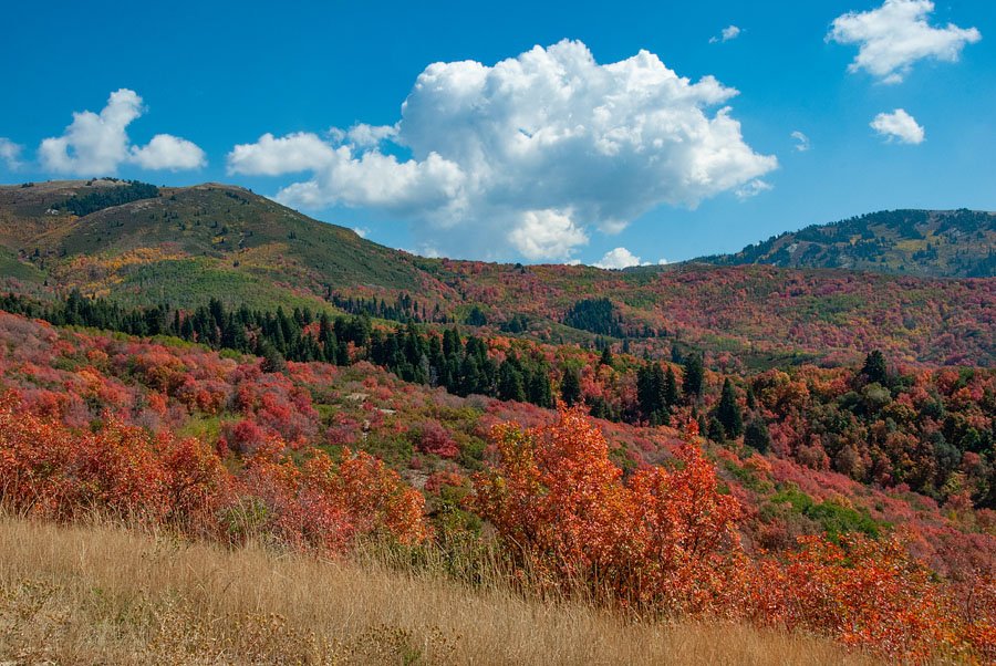
Fall colors in the Wasatch Mountain range
Title: Fall colors in the Wasatch Mountain range
Location: Wasatch Mountains, Wasatch National Forest, Skyline Drive, Davis County, Utah
Date: 9/28/2012
Bountiful Peak in autumn
Title: Bountiful Peak in autumn
Location: Wasatch Mountains, Wasatch National Forest, Skyline Drive, Davis County, Utah
Date: 9/28/2012

Fall colors and Bountiful Peak
Title: Fall colors and Bountiful Peak
Location: Wasatch Mountains, Wasatch National Forest, Skyline Drive, Davis County, Utah
Date: 9/28/2012

Fall colors and the Wasatch Mountains
Title: Fall colors and the Wasatch Mountains
Location: Wasatch Mountains, Wasatch National Forest, Skyline Drive, Davis County, Utah
Date: 9/28/2012