
Wayne County Images
As a bird and wildlife photographer I believe that Wayne County is terrific because of all the birds and wildlife it has. The unique geology of the area makes for stunning vistas everywhere I have gone in the county. I could easily spend months at a time in Wayne County and still never see all that it has to offer.
The eastern border of Wayne County is delineated by the meanders of the Green River, which flows southward to discharge into the Colorado River. After the two rivers join, the combined southwestern flow forms the remaining portion of the county’s eastern border. The central part of the county is drained by the Fremont River and Muddy Creek. The Fremont begins at Fish Lake in Sevier County and flows into Wayne County near its northwestern corner. It joins the Muddy near Hanksville to form the Dirty Devil River, which flows southeastward out of the county’s southern border to discharge into Colorado. Wayne County terrain varies from rough forestland on the west to arid poor soil carved by drainages and rocky outcrops.
National forests/parks In Wayne County:
Canyonlands National Park
Capitol Reef National Park
Dixie National Forest
Fishlake National Forest
Glen Canyon National Recreation Area
I hope you enjoy my Wayne County, Utah photos.
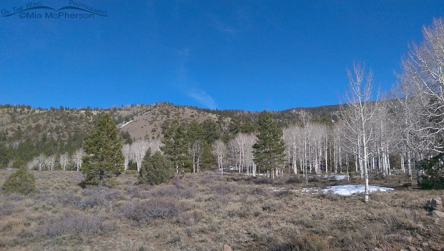
Aspens, Ponderosa Pines, blue sky and snow
Title: Aspens, Ponderosa Pines, blue sky and snow
Location: Wayne County, Utah
Date: 3/26/2015
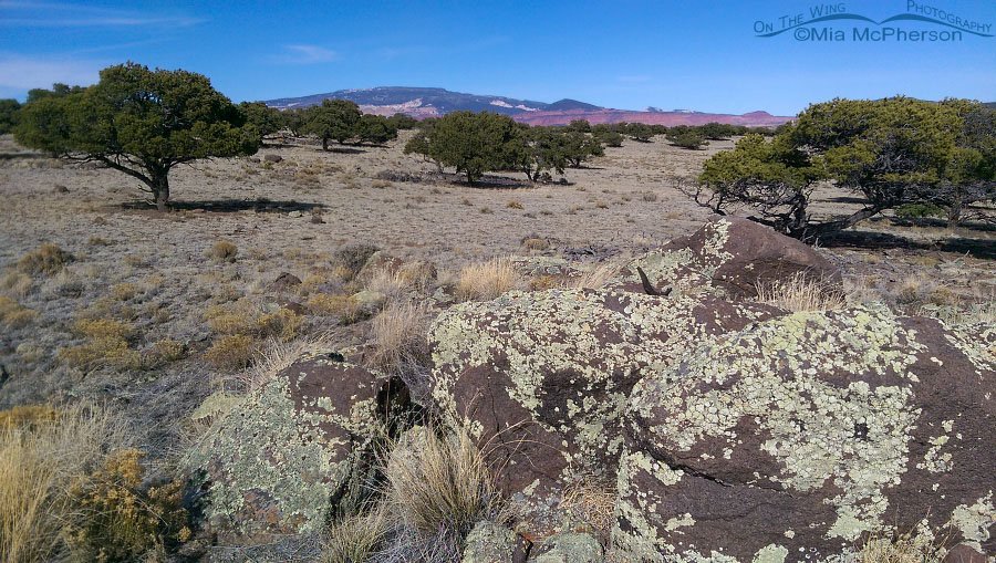
Going up to Boulder Top
Title: Going up to Boulder Top
Location: Wayne County, Utah
Date: 3/26/2015
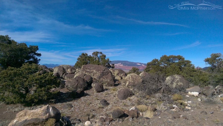
Wayne County campsite, day 2
Title: Wayne County campsite, day 2
Location: Wayne County, Utah
Date: 3/26/2015
Colorful sunset at a campsite in Wayne County, Utah
Title: Colorful sunset at a campsite in Wayne County, Utah
Location: Wayne County, Utah
Date: 3/26/2015
Journey to Capitol Reef National Park in 2015
Title: Journey to Capitol Reef National Park in 2015
Location: Capitol Reef National Park, Wayne County, Utah
Date: 3/25/2015
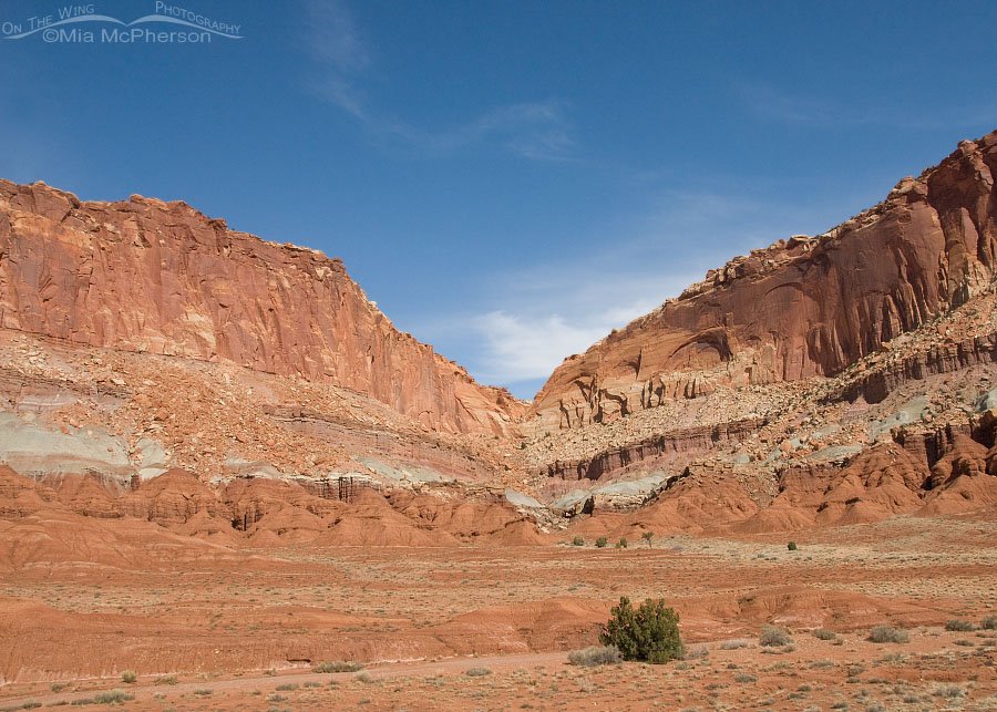
Utah – The State with Billions of Views
Title: Utah – The State with Billions of Views
Location: Capitol Reef National Park, Wayne County, Utah
Date: 3/13/2014
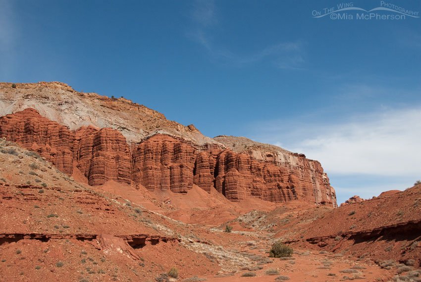
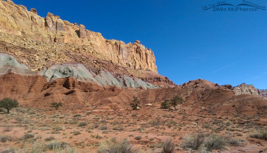
Capitol Reef NP on a clear day
Title: Capitol Reef NP on a clear day
Location: Capitol Reef National Park, Wayne County, Utah
Date: 3/13/2014
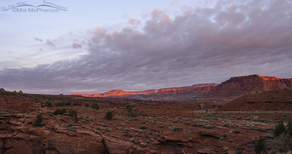
Wayne County, Utah pastel sunrise
Title: Wayne County, Utah pastel sunrise
Location: Wayne County, Utah
Date: 3/13/2014
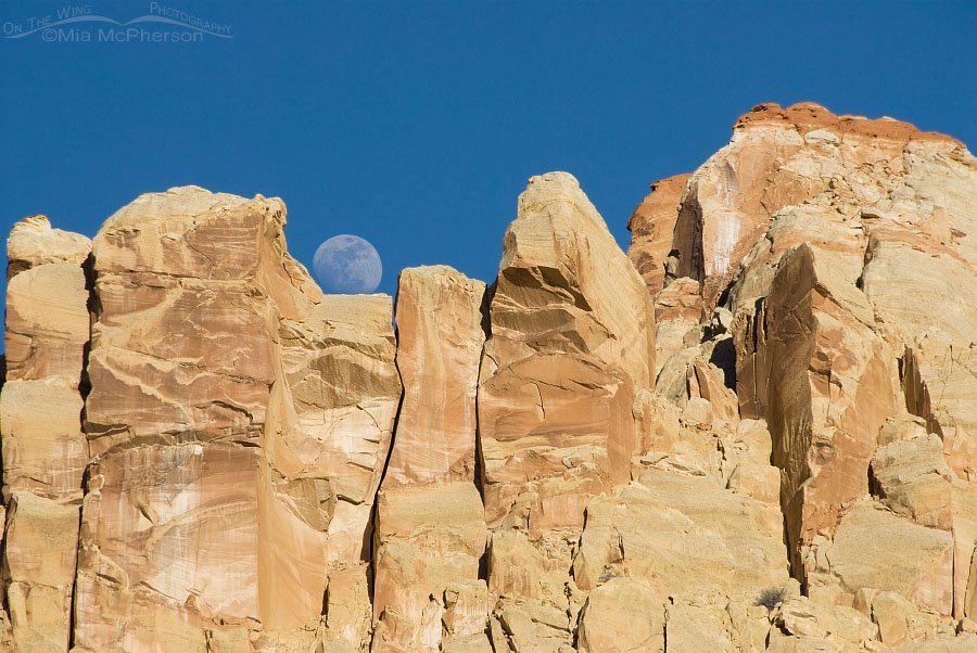
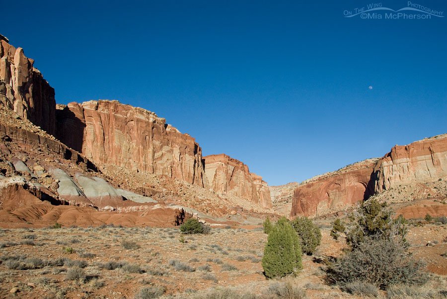
Moon rise over Capitol Reef National Park
Title: Moon rise over Capitol Reef National Park
Location: Capitol Reef National Park, Wayne County, Utah
Date: 3/12/2014
Capitol Reef in March 2014
Title: Capitol Reef in March 2014
Location: Capitol Reef National Park, Wayne County, Utah
Date: 3/12/2014
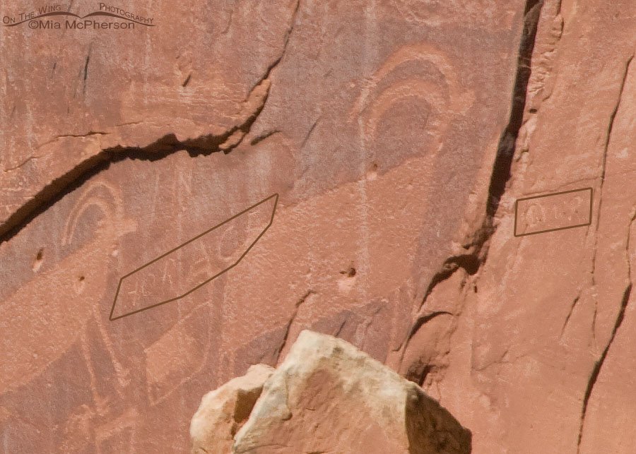
Defacement of the Capitol Reef Sheep Petroglyph
Title: Defacement of the Capitol Reef Sheep Petroglyph
Location: Capitol Reef National Park, Wayne County, Utah
Date: 3/12/2014
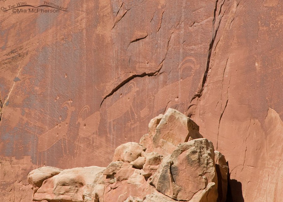
Capitol Reef Sheep Petroglyph
Title: Capitol Reef Sheep Petroglyph
Location: Capitol Reef National Park, Wayne County, Utah
Date: 3/12/2014
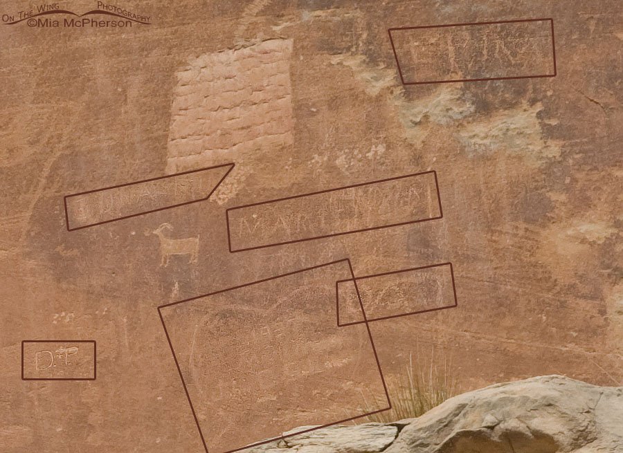
Defaced Capitol Reef Anthropomorphs Petroglyphs
Title: Defaced Capitol Reef Anthropomorphs Petroglyphs
Location: Capitol Reef National Park, Wayne County, Utah
Date: 3/12/2014
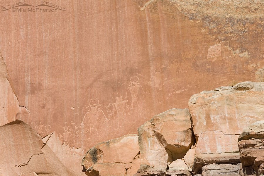
Capitol Reef Anthropomorphs Petroglyphs
Title: Capitol Reef Anthropomorphs Petroglyphs
Location: Capitol Reef National Park, Wayne County, Utah
Date: 3/12/2014
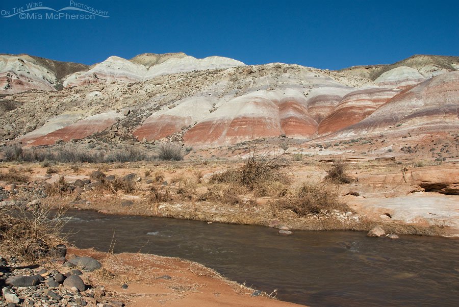
Late winter view of the Fremont River
Title: Late winter view of the Fremont River
Location: Capitol Reef National Park, Wayne County, Utah
Date: 3/12/2014
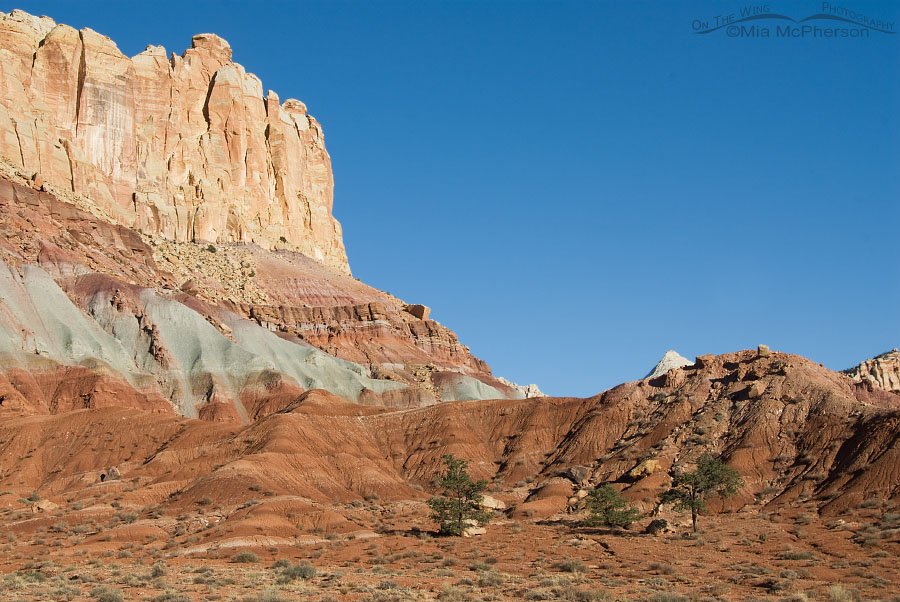
Layers of Time – Capitol Reef National Park
Title: Layers of Time – Capitol Reef National Park
Location: Capitol Reef National Park, Wayne County, Utah
Date: 3/12/2014
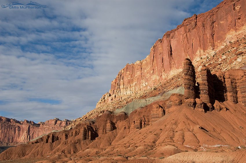
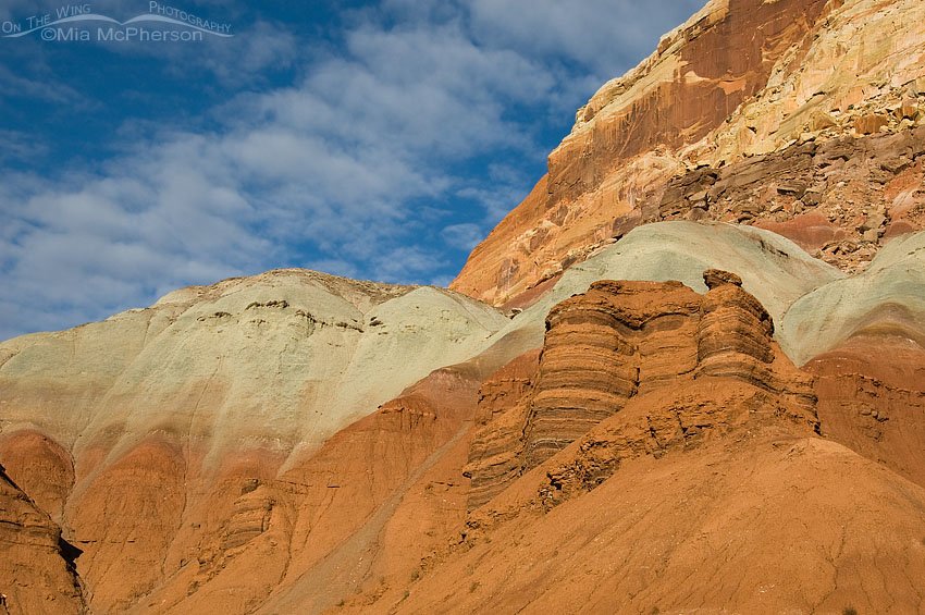
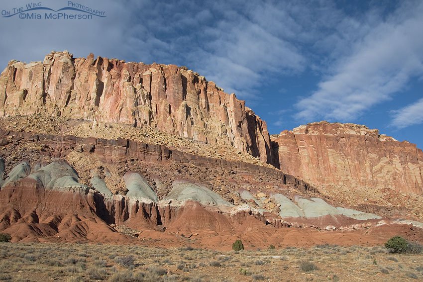
Capitol Reef National Park Rocks!
Title: Capitol Reef National Park Rocks!
Location: Capitol Reef National Park, Wayne County, Utah
Date: 10/23/2009
Just have to Love Capitol Reef NP
Title: Just have to Love Capitol Reef NP
Location: Capitol Reef National Park, Wayne County, Utah
Date: 10/23/2009
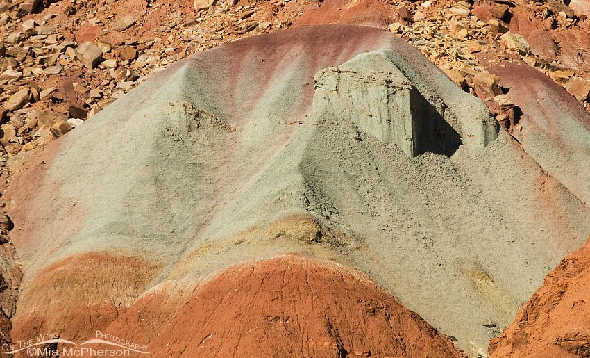
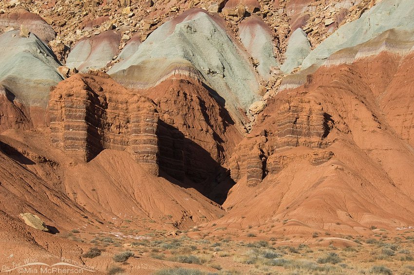
Capitol Reef National Park close up
Title: Capitol Reef National Park close up
Location: Capitol Reef National Park, Wayne County, Utah
Date: 10/23/2009
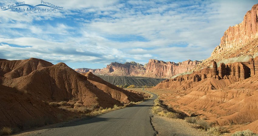
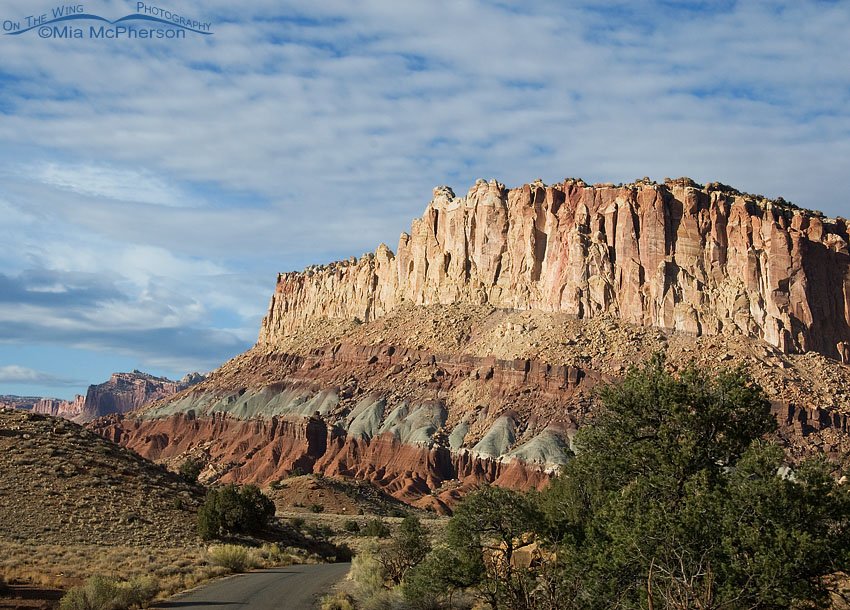
Road through Capitol Reef National Park
Title: Road through Capitol Reef National Park
Location: Capitol Reef National Park, Wayne County, Utah
Date: 10/23/2009
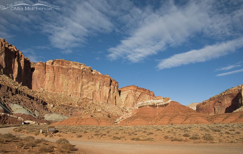
Fluffy clouds over Capitol Reef National Park
Title: Fluffy clouds over Capitol Reef National Park
Location: Capitol Reef National Park, Wayne County, Utah
Date: 10/23/2009
Capitol Reef National Park formations
Title: Capitol Reef National Park formations
Location: Capitol Reef National Park, Wayne County, Utah
Date: 10/23/2009
Capitol Reef National Park and soft clouds
Title: Capitol Reef National Park and soft clouds
Location: Capitol Reef National Park, Wayne County, Utah
Date: 10/23/2009
Capitol Reef National Park drive in evening light
Title: Capitol Reef National Park drive in evening light
Location: Capitol Reef National Park, Wayne County, Utah
Date: 10/23/2009